If you like snow, you'll love this

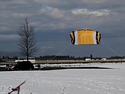
Who says snow and kites don't mix? On a breezy afternoon last week, Ron Reeve took his dual line stunt kite out for some exercise at Croffoot Park on Lancaster and Ramsey roads.
RON REEVE/Courtesy
The snowfall season is revving up across North Idaho and the rest of the Inland Empire. As of Saturday, Cliff had measured 15.2 inches compared to a normal to date of about 3 inches.
Last year at this time, we had 6.6 inches at his station in northwestern Coeur d’Alene. At Spokane International Airport, a healthy 10 inches of snow has fallen for the season.
In the mountains, we’ve already seen close to 50 inches of snow at Lookout Pass. Most other locations have received over 2 feet of snow for the early start of the 2020-21 season with more on the way.
This November is very different than the one in 2019. During that year, only 0.1 inches of snow fell for the entire month, a record for the least amount of snow in November.
As I mentioned earlier, conditions are looking very good for an above-normal snowfall season across the Inland Northwest.
The Circumpolar Vortex, which is a huge upper-level low pressure system, has recently backed up over the western portions of the Northern Hemisphere. We continue to have very low sunspot activity and ocean waters in the south-central Pacific Ocean are still cooling. In fact, Australian forecasters of sea-surface temperatures are predicting a “moderate to strong” La Nina, the cooler-than-normal sea-surface temperature event, into early next year.
During the record-breaking snowy season of 2007-08 when 172.9 inches fell in Coeur d’Alene, there were very few sunspots and we also had a moderate La Nina.
To get the good snows here in the Inland Northwest, the upper-level wind-flow patterns usually originate from the northwest. So far, the long-range computer models are showing more storms from the Pacific Ocean that will move in from that region, so it’s looking good for more snow later this month. Cliff and I believe we’ll see occasional rain and snow this week.
However, toward the Thanksgiving holiday weekend, it does look like there will be more snow as more storms will originate from the colder northwestern area of the Gulf of Alaska.
Speaking of snow, here are some of the most interesting snowfall records across the globe:
According to numerous weather sources, the most snow in a season, which is from July 1 through the following June 30, was a whopping 1,140 inches, or 95 feet, at Mount Baker in Washington during the 1998 through 1999 season.
Mount Rainier holds the record for most snow during any 12-month period. From Feb. 19, 1971 to Feb. 18, 1972, slightly more than 1,240 inches of snow fell. In one calendar month, Tamarack, Calif. reported 390 inches in January 1911, a record that still holds nearly 110 years later.
In other parts of the world, some of the snowiest places in the world include the mountains in the western and eastern U.S. as well as other mountainous areas in France, Japan and western Canada.
According to TripsToDiscover.com, Aomori City in Japan receives about 312 inches of snow per year. Aomori City is located at the highest elevation in the Hakkoda Mountains and has a population of around 300,000 people.
Another mountainous location, Niseko, Japan, picks up an average of nearly 50 feet of snow per year and is considered to be one of the snowiest places on the planet.
In terms of snowflake sizes, the smallest ones are called Diamond Dust crystals and usually have the diameter of a human hair. According to SnowCrystals.com, about a million billion snowflakes fall each second across the globe. They say it’s estimated to be enough to make one snowman for every person on earth every 10 minutes.
Most snowflakes are small, but there have been occasions when the snowflake becomes much bigger. The world’s largest snowflake was reported at Fort Keough, Mont. on Jan. 28, 1887 when it was measured to be about 15 inches wide and close to 8 inches in thickness.
It was first discovered that no two snowflakes are alike by a Vermont man, William Bentley, also known as “Snowflake Bentley,” in the late 1880s. During Wilson’s 50-year-plus career, he painstakingly photographed more than 5,300 distinct patterns of snow crystals concluding accurately that "no two snowflakes have ever been identical."
In 1885, at age 20, Bentley successfully adapted his microscope to a bellows-type camera and soon became the first person to photograph a single snow crystal. In fact, in his 66-year lifetime, Wilson collected more photographic negatives of snowflakes than all other observers combined. His photographs also proved that all snowflakes are "hexagonal," or "six-sided."
Bentley’s photographs have been featured in literally hundreds of books, magazines and newspapers around the world. It’s almost hard to believe that the estimated billion million snowflakes that fall each second are different from one another.
• • •
Contact Randy Mann at randy@longrangeweather.com