Growth generating gridlock

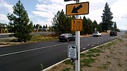
RALPH BARTHOLDT/Press Traffic travels along Seltice Way through the roundabout at the intersection with Atlas Road on Saturday morning. The recently rebuilt intersection was built to handle increased traffic.
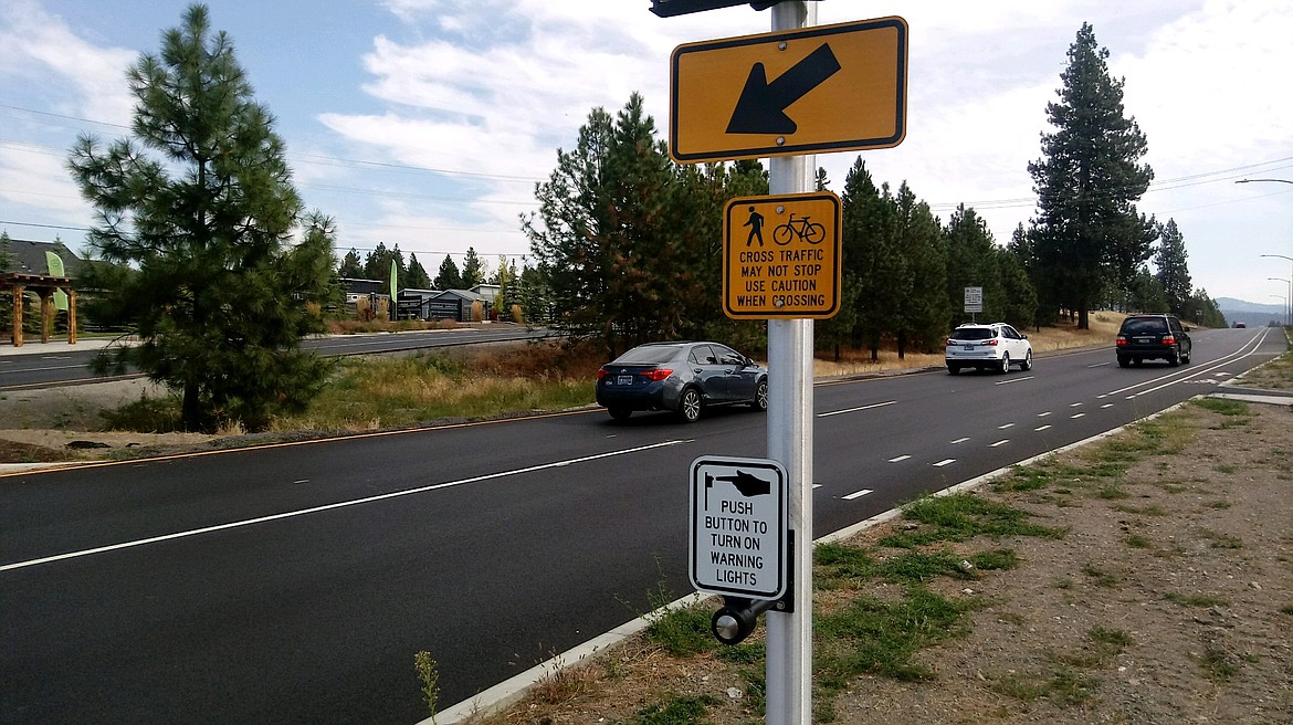
A crosswalk for pedestrians is in place at the Atlas Road roundabout adjacent to the Atlas Mill site.

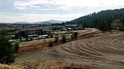
The spot where the Atlas Mill site abuts Riverstone, next to the Centennial Trail. (Photos by RALPH BARTHOLDT/Press)
COEUR d’ALENE — On most afternoons midweek, cars dribble from intersections and parking lots along Northwest Boulevard in Coeur d’Alene like water from a leaking spout.
By 5 p.m. the vehicles plunge into the main flow that heads mostly north from downtown and Riverstone toward the Interstate 90 interchange. What’s left streams north on Ramsey Road like a faucet with an open valve. Every day, around 31,000 cars, vans, pickup trucks and transports rumble north on Ramsey Road through the Kathleen Avenue light.
It’s all part of the congestion that is not yet dysfunction, but sometimes feels like it.
“Traffic in that area has been a real challenge,” Coeur d’Alene Chief of Police Lee White said. “But I don’t think you need the police chief to tell you that.”
That’s because anyone who has had the experience of crawling through the half dozen or more traffic lights on the stretch near I-90 understands the relief of leaving them in the rear view mirror.
The traffic backs up into the Riverstone development to the south, and doesn’t thin out until Kathleen Avenue to the north.
Population growth and two new, large developments slated nearby can only aggravate the situation.
The city’s population is expected to jump from 51,000 today to 81,000 by 2035, and the Coeur d’Alene area is said to be the fastest-growing metropolitan area in Idaho and just shy of the top-10 list of fastest growing regions in the nation, according to the Census Bureau.
The population of Post Falls is projected to surpass Coeur d’Alene’s in the next 20 years.
All of this is relevant if not pertinent information for Melissa Cleveland, whose job it is to keep the traffic flowing, safely and quickly.
And it may be daunting.
Cleveland is an engineer for Welch Comer, which is contracted by the City of Coeur d’Alene and ignite cda, the city’s development agency, to collect data and crunch numbers into models to help officials make traffic decisions.
The $88,000 study paid by ignite and the city, which should be completed by the end of the year, will help ascertain how traffic generated by large-scale developments at the former Atlas Mill Site and neighboring 870-unit Rivers Edge apartments will affect the Northwest Boulevard logjam.
Over the past several months Cleveland and her crew have collected traffic data from 15 intersections from Riverstone along Northwest Boulevard to West Golf Course Road, home of the Kroc Center.
The next step will be to clump and analyze the data.
“And then we’ll add these developments and see what would happen,” Cleveland said.
There are a lot of potential outcomes that must be vetted, she said.
“We want the most accurate depiction of what would happen, and then add alternatives,” she said.
The models and alternatives would be subject to further scrutiny, before the results are turned over to the city.
Despite the precautions, property owners at Riverstone, where stop-and-go development for 15 years has reached a noticeable crescendo, brace for what is next.
Traffic from the 48-acre Atlas development to the immediate west will likely flow through Riverstone where Mark Hall lives.
“My only concern is how it impacts Riverstone traffic-wise,” Hall said. “It seems to me Riverstone already has some traffic issues, and we don’t need more impact.”
Ruth Pratt of Riverstone likes the idea of the Atlas development but said the biggest concerns she and neighbors have is how Atlas traffic will impact the Centennial Trail, which runs through Riverstone and appears, at least on some future maps, as a road.
She fears building another access point through Riverstone to alleviate traffic could put the trail at risk.
“We understand nothing is settled yet,” Pratt said. “That trail is currently a hub for five different areas to come into it, and will continue to be a hub.”
The traffic study considers opening another access to Riverstone at West LaCrosse Avenue, something property owners at Bellerive Lane, which parallels the river at the southeastern edge of Riverstone, fear will bring overflow traffic to their front door.
Right now, the 1,000 or so residents of Riverstone enjoy moderate traffic, which can plug up intersections briefly at high-volume times.
“It comes in bursts,” Cleveland said.
City engineer Chris Bosley said the LaCrosse access has been on the city’s radar for some time.
“It’s been envisioned for a while,” Bosley said.
Despite the amount of work to collect data, crunch numbers and incorporate the figures into models, Bosley said, how much traffic the Atlas site and Rivers Edge site generates depends on factors that the study cannot know.
Where occupants work will determine which routes they use, and which direction they go. What time they use the streets — at midday, midnight or during the usual hours — also won’t be known, and whether or not they own a vehicle will not be part of the data used in the traffic study.
“A lot of it is a guessing game,” he said.
In addition, traffic flow can be manipulated by traffic signals, and the signals on Northwest Boulevard near I-90 are operated by the state, not the city.
“We’ve been in discussions with ITD about taking control of those signals, so we can better regulate traffic there,” Bosley said.
That has not yet happened.
If there is certainty about something, it is that traffic will increase.
Officials hope the latest study will find a way to make its impact less painful.