
Winter on a comeback
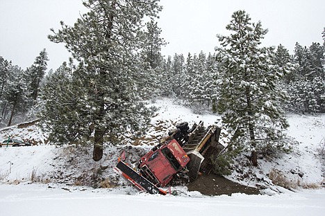
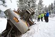
<p>A Kootenai County Groomer Program truck slumps over the edge of East Fernan Lake Road Wednesday after the driver maneuvered to avoid colliding with an oncoming van. Icy conditions made recovery of the vehicle difficult for tow trucks, causing an extended delays for drivers along East Fernan Lake Road.</p>
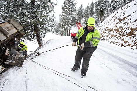
<p>Ron from Merwin’s Towing pulls a cable attached to a Kootenai County Groomer Program truck that went over the edge of East Fernan Lake Road Wednesday while trying to avoid hitting an oncoming van. No injuries occurred during the incident.</p>
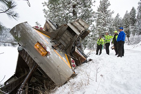
<p>Tow truck drivers collaborate on a plan to recover a Kootenai County Groomer Program truck that went off East Fernan Lake Road while avoiding a collision with a van Wednesday morning.</p>
COEUR d'ALENE - Mother Nature dumped 5.6 inches of snow in Kootenai County as of Wednesday afternoon, and climatologist Cliff Harris said another 4 inches should pile up before it quits snowing today.
"We had more snow in 24 hours than we have had all month," Harris said. "All of the other snow this month adds up to 5.5 inches, for a total of 11.1 inches for the month so far.
Harris said a normal snow pattern has now settled in place after a massive high pressure front that kept our region unusually dry for weeks has broken up.
In fact, he said, there were two six-week patterns that kept the West Coast much drier than normal this winter.
While that has caused major drought problems for some states such as California, which just went through its driest year on record, North Idaho has been getting a little more rain and a little more snow in the mountains.
"We've had about 2 inches of rain and our normal rainfall is about 3 inches," Harris said. "We are OK as far as total precipitation goes.
"We should start to catch up now," he said, "but snowfall will still be 25 to 30 inches below normal for the season."
Normal snowfall in Kootenai county is 68.9 inches and Harris expects our region to finish the season with close to 40 inches of snow.
He said we have had above-normal temperatures this winter, causing most of our precipitation to fall as rain. That is going to change as we head into the weekend.
Harris predicts that the temperatures will start dropping on Friday to highs in the 20s and lows in the teens.
"That should start this weekend and go through the middle of next week," he said. "Whatever snow falls should stick around until Feb. 10th or so.
"This will be the longest sustained snow cover we have had all season," he said. "Who knows? People just may have a white Valentine's Day."